The world is full of Natural Beauty. And Man always want to know about them and try to visit them. But everyone can't visit. For them, we are collecting all the Natural Resources information in our site.
Keokradong is the second highest mountain and one of the best natural resource of Bangladesh. It is about 4332 ft high from the sea level. It is 30km away from the Ruma sadar Upazilla. During the winter season many adventurous tourists endeavor to visit this spectacular mountain. This remote hilly region is full of natural beauty. You can be overwhelmed at the first sight of this mountain. It is very close to the Myanmar border and you can see an endless courses of mountains and hills. This area is covered with dense forests full of beast and animals.
Road beside the hill - Natural Resource
Food & Accommodations :- On the way to Keokradong one have to pause his journey at Bogalake for restoration. There is no other accommodation facility except the rest houses of district council in Bogalake. One have to start his walking early in the morning from Bogalake to reach Keokradong. It will require 5 to 6 hours to reach Keokradong. Tourists have to hold that night in the near about tribe village and they have to start for Bogalake next morning.
People Boating beside hill - Natural Resource
Tourists have to carry dry food , water purifying tablet warm clothes, torch light, orsallaine, anti mosquito lotion and other necessary medicines. This journey is very much laborious, so it is better to avoid children and women to take along with you. There are some residential hotels in Ruma Bazar, so you have to confirm at first the hotel reservation before going to Ruma, otherwise you will have no alternative passing the night under the open sky. If you are fortunate you can avail tribal house to pass the night.
Communication :- Ruma is 50 kilometer away from Bandarban. Due to lack of developed communication and transportation it is a remote upzila Bangladesh. For visiting Keokradong you have to go to Ruma at first. On the way heading to Ruma you have to register your name & address in the nearby military check post.
Waterfall from the mountain - Natural Resource
You should keep it mind that after 4 p.m nobody is allowed to leave Ruma for BogaLake, Keokaradong, Tahjingdong. In rainy season you can go upto koikhhong jhiri by jeep. From that place you have to undertake one hour boat journey to Ruma. In winter season you can go up to Ruma Bridge Ghat and from the place you need 15 to 20 minutes boat journey to arrive in Ruma. From Ruma sadar you can hire pickup or jeep up to BogaLake and you have to walk through the hills from BogaLake to Keokradong.
Press Here to know more about Keokradong Mountain. If you like it, then don't forget to leave your comments here. Thanks.
The Padma (Bengali: পদ্মাPôdda) is a major trans-boundary river in Bangladesh. It is the main distributary of the Ganges (Bengali: গঙ্গাGôngga), which originates in the Himalayas. The Padma enters Bangladesh from India near Chapai Nababganj. It meets the Jamuna (Bengali: যমুনাJomuna) near Aricha and retains its name, but finally meets with the Meghna (Bengali: মেঘনা) near Chandpur and adopts the name 'Meghna' before flowing into the Bay of Bengal. Rajshahi, a major city in western Bangladesh, is situated on the north bank of the Padma. Its maximum depth is 1,571 feet (479 m) and average depth is 968 feet (295 m).
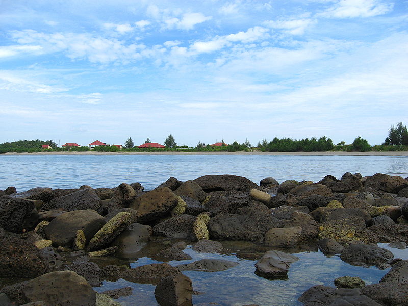
River Side
Originated in the Gangotri Glacier of the Himalaya, the Ganges runs to the Bay of Bengal through India, entering Bangladesh at Shibganj in the district of Chapai Nababganj. Just west of Shibganj, the distributary Bhagirathi emerges and flows southwards as the Hooghly. After the point where the Bhagirathi branches off, the Ganges is officially referred to as the Padma and the river Bhagirathi uses the name of Ganga. Later the British started calling it the Hoogly river.
Boat on Padma River
Further downstream, in Goalando, 2200 km away from the source, the Padma is joined by the mighty Jamuna (Lower Brahmaputra) and the resulting combination flows with the name Padma further east, to Chandpur. Here, the widest river in Bangladesh, the Meghna, joins the Padma, continuing as the Meghna almost in a straight line to the south, ending in the Bay of Bengal.
The Padma (Sanskrit for lotus flower is numerously mentioned in Hindu Mythology including the Vedas, the Puranas, the Ramayana and the Mahabharata. In all the epic stories, the river is mentioned as byname for the Goddess Lakshmi though the origin differs. After building of Farakka Barrage on the upstream of the river in Indian West Bengal the capacity of the river was reduced significantly.A road-rail bridge is proposed in 2009.Padma bridge is the largest bridge of Bangladesh(proposed). It will cost ৳3000 kuti to finish. It will be used in 2013.
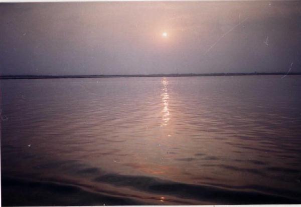
Rising Sun at Padma
Press here to know more about the Padma river. If you liked, don't forget to leave your comments. Thanks.
St. Martin's Island '(Bengali: সেন্টমার্টিন দ্বীপ) is a small island in the northeast of the bay of bengal, about 9 km south of the Cox's Bazar-Teknaf peninsular tip and forming the southernmost part of Bangladesh. It is about 8 km west of the northwest coast of Myanmar at the mouth of the river naf. The island lies between 92°18´ and 92°21´E longitudes and 20°34´ and 20°39´N latitudes. The local people call it Narikel Jinjira. It is almost flat and is 3.6m above the mean sea level. The 9.66 km wide channel between the mainland and the island is much shallower than the open sea southwest of the island. There are reefs from 10-15 km to the west-northwest.
Beach Side
The island is 7.315 km long and is aligned NNW and SSE. Geographically, it is divided into three parts. The northern part is called Narikel Jinjira or Uttarpara and is 2,134m long and 1,402m wide. The southern part is known as Dakshinpara, which is 1,929m long, with a narrow tail of 1,890m towards the southeast, and a maximum width of 975m. A narrow central belt or Maddhyapara connects the two parts. The length and the width of this belt are about 1,524m and 518m respectively and the narrowest collar is known as Golachipa. In addition to the main island there are a number of tiny islets ranging from 100 to 500 sq m which are locally known as Chheradia or Siradia which means separated island.
There is a shallow lagoon in the middle of Uttarpara and it is connected to the sea during high tide by a narrow channel on the western coast. The topsoil of Uttarpara consists of alluvial sands mixed with shells of molluscs. There are two small dead lagoons and a stretch of marshy land in Dakshinpara. Fish landing sites, bazars and schools are present only in Uttarpara.
Boats
Launches and country boats ply between the island and teknaf regularly. The population is about 3,700 and most of them are fishermen belonging to 535 families. One hundred eighty-two species of wildlife are recorded from the island. Of these, 4 species are amphibians, 28 reptiles, 130 birds and 20 mammals. tourism to the northern part of the island exists during four months (November to February). The most densely populated part is Jinjira. There is scarcity of sweet water on the island. Only a few ponds and a number of tubewells supply sweet water for drinking as well as for cultivation. Though the island falls in the monsoon zone, the climate is much influenced by the sea. The main vegetation is coconut, betel nut and bamboo. Coconut trees are abundant and more concentrated in the Jinjira area. The soil of the island is not so fertile. The main agricultural products are onion, watermelon and some rice.
The geological structure of the island is simple and is represented by an anticlinal uplift. A little of the axis of the anticline is traceable along the west coast of Dakshinpara. The exposed portion of the axis runs NNW to SSE, approximately parallel to the island. There is a fault along the northwestern shoreline with a trend nearly parallel to the axis. St Martin's limestone is composed of molluscan coquina horizons (shelly limestone) and coral clusters (coralline limestones). Being very porous and permeable, the shelly limestone provides an excellent aquifer wherever they occur beneath the alluvium. Recent marine sands and the shelly limestone are the chief source of fresh water.
Kaakra's at beach
Several living small coral colonies are found in small sheltered pools very near the low tide level around the island. They also occur in the surrounding shallow sea, mostly growing on the beach rocks and calcareous sandstone concretions. The dead coral colonies also occur in pool-like depressions within the high and low tide levels. Some of them are located at an elevation of nearly 3.50m above the low tide level. The oldest fossil coral belongs to Late Pleistocene, giving an age of 33,238 years (C14 dating). The clearest indication of the Holocene upliftment of the island is the appearance of an emerged 3.0m coquina limestone cliff on the coast of Dakshinpara ranging in age from 450 years at the base to 292 years at the top (C14 dating). The mean uplifting rate of the island, calculated from the above data, is 19.0 mm/year. The location of the cliff is 1.5m above the present high tide level and on the eastern upthrown faulted block.
The emerged dead corals characterised by Porites sp, Acropora sp, Cyphostrea sp, and Platygyrn sp provide evidence of lower level emergence, ie, they have been raised above the level at which they are at present forming/living. The radiocarbon dates from emerged dead corals are recorded below the ultra low level liquid scintillator's detection limit (ie 0 BP). This suggests that the dead corals have emerged fairly recently, indeed are still in the process of emerging. This means that the environment of St Martin's Island is now not favourable for the growth and development of the only coral island of the country that started forming at least since the last maximum glacial age (ca 40,000 years ago).
Click Here to read more about St. Martin's Island.
Kuakata (Bangla: কুয়াকাটা) is a panaromic sea beach on the southernmost tip of Bangladesh and one of the oldest natural resource of Bangladesh. It is located in the Patuakhali district, Kuakata has a wide sandy beach from where one can see both the sunrise and sunset. It is about 320 Kilometres south of Dhaka, the capital, and about 70 Kilometres from the district headquarters. The Kuakata beach is 30 km long and 6 km wide. On 13 September 2007 government had announced a red alert in Kuakata as caution for a possible Tsunami.
Sunrise from Kuakata
The name Kuakata originated from the word 'Kua'-the Bengali word for “Well” which was dug on the sea shore by the early Rakhine settlers in quest of collecting drinking water, who landed on Kuakata coast in the eighteenth century after being expelled from Arakan (Myanmar) by the Mughals. Afterwards, it has become a tradition of digging Well in the neighborhoods of Rakhaine tribes for water.
Kuakata offers a full view of the sunrise and sunset from the same white sandy beach in the water of the Bay of Bengal.
Sunset from Kuakata
Locally known as Shagor Kannya (Daughter of the Sea), the long strip of dark, marbled sand stretches for about 30 km. The long and wide beach at Kuakata has a typical natural setting. This sandy beach has gentle slopes into the Bay of Bengal. Kuakata is also a sanctuary for migratory winter birds.
Kuakata Beach
On the eastern end of the beach is GongamatiReservedForest, an evergreen mangrove forest and snippet of the original Kuakata. When the Rakhines settled in the area in 1784, Kuakata was part of the larger Sundarbans forest. However, the Sundarbans is now at a distance of one-hour by speed boat. As a mangrove forest, Gongamati, like the Sundarbans, offers some protection against tidal surges, however it too is being threatened by logging and deforestation. The best way to reach the forest is by foot or bike along the beach, where a flock of flag flying fishing boats can be seen trawling the coast. Choosing to visit Gangamati in the late afternoon is a perfect time to watch the sun caste shadows on the abstract exposed mangrove roots.
Boats
Kuakata is the place of pilgrimage for both Hindu and Buddhist communities. Innumerable devotees arrive here at the festival of 'Rush Purnima' and 'Maghi Purnima'. On these two occasions the pilgrims take holy bath at the bay and participate in the traditional fairs. One may also visit the 100 years old Buddhist Temple where the statue of Goutama Buddha and two wells of 200 years old are located.
Fisherman village is another place where you can visit and watch the lifestyle of the fisherman. If you are adventurous you may also go for fishing on the fishing boat if you can manage the local fishermen. That will give you pleasure and experience, which you won’t be able to gather from anywhere else. In the fishermen village you will find the fishermen coming back from the sea and you can purchase some fresh hilsha fish from them, and by the side of village there are some local restaurants where you can get the Hilshas cooked and ready for eating.
Mangrove Forest
The government and local business owners have made significant developments over the years to attract tourist to its shores.
Nowadays, local people are more supportive to the tourists and communications have improved significantly. A new Police station was built in 2007. Accordingly, the law and order situation in the open beach, even at night, has improved significantly.
The Sundarbans (Bengali: সুন্দরবন, Shundorbôn) is the largest single block of tidal halophytic mangrove forest in the world.The name Sundarban can be literally translated as "beautiful jungle" or "beautiful forest" in the Bengali language (Shundor, "beautiful" and bon, "forest" or "jungle"). The name may have been derived from the Sundari trees that are found in Sundarbans in large numbers. Alternatively, it has been proposed that the name is a corruption of Samudraban (Bengali: সমুদ্রবনShomudrobôn "SeaForest") or Chandra-bandhe (name of a primitive tribe). But the generally accepted view is the one associated with Sundari trees.
The forest lies in the vast delta on the Bay of Bengal formed by the super confluence of the Padma, Brahmaputra and Meghna rivers across Saiyan southern Bangladesh. The seasonally-flooded Sundarbans freshwater swamp forests lie inland from the mangrove forests on the coastal fringe. The forest covers 10,000 sq.km. of which about 6,000 are in Bangladesh. It became inscribed as a UNESCO world heritage site in 1997. The Sundarbans is estimated to be about 4,110 km², of which about 1,700 km² is occupied by waterbodies in the forms of river, canals and creeks of width varying from a few meters to several kilometers.
The Sundarbans is intersected by a complex network of tidal waterways, mudflats and small islands of salt-tolerant mangrove forests. The interconnected network of waterways makes almost every corner of the forest accessible by boat.
Mangroves
The area is known for the eponymous Royal Bengal Tiger (Panthera tigris tigris), as well as numerous fauna including species of birds, spotted deer, crocodiles and snakes. The fertile soils of the delta have been subject to intensive human use for centuries, and the ecoregion has been mostly converted to intensive agriculture, with few enclaves of forest remaining. The remaining forests, taken together with the Sundarbans mangroves, are important habitat for the endangered tiger. Additionally, the Sundarbans serves a crucial function as a protective barrier for the millions of inhabitants in and around Khulna and Mongla against the floods that result from the cyclones. The Sundarbans has also been enlisted among the finalists in the New7Wonders of Nature as natural resource.
Nature Of Sundarbans
The Sundarbans flora is characterized by the abundance of Heritiera fomes, Excoecaria agallocha, Ceriops decandra and Sonneratia apetala. A total 245 genera and 334 plant species were recorded by David Prain in 1903. Since Prain’s report there have been considerable changes in the status of various mangrove species and taxonomic revision of the man-grove flora. However, very little exploration of the botanical nature of the Sundarbans has been made to keep up with these changes. Whilst most of the mangroves in other parts of the world are characterized by members of the Rhizophoraceae, Avicenneaceae or Laganculariaceae, the mangroves of Bangladesh are dominated by the Sterculiaceae and Euphorbiaceae.
Faunas
The Bangladesh mangrove vegetation of the Sundarbans differs greatly from other non-deltaic coastal mangrove forests and upland forests associations. Unlike the former, the Rhizophoraceae are of minor importance. Differences in vegetation have been explained in terms of freshwater and low salinity influences in the Northeast and variations in drainage and siltation. The Sundarbans has been classified as a moist tropical forest demonstrating a whole mosaic of seres, comprising primary colonization on new accretions to more mature beach forests, often conspicuously dominated by Keora (Sonneratia apetala) and tidal forests. Historically three principal vegetation types have been recognized in broad correlation with varying degrees of water salinity, freshwater flushing and physiography and which are represented in the wildlife sanctuaries:
Sundari Tree
Sundari and Gewa occur prominently throughout the area with discontinuous distribution of Dhundul (Xylocarpus granatum) and Kankra. Among grasses and Palms, Poresia coaractata, Myriostachya wightiana, Imperata cylindrica, Phragmites karka, Nypa fruticans are well distributed. Keora is an indicator species for newly accreted mudbanks and is an important species for wildlife, especially spotted deer (Axis axis). Besides the forest, there are extensive areas of brackish and freshwater marshes, intertidal mudflats, sandflats, sand dunes with typical dune vegetation, open grassland on sandy soils and raised areas supporting a variety of terrestrial shrubs and trees.
Lauadaga Snake
Succession is generally defined as the successive occupation of a site by different plant communities. In an accreting mudflats the outer community along the sequence represents the pioneer community which is gradually replaced by the next community representing the seral stages and finally by a climax community typical of the climatic zone. Troup suggested that succession began in the newly accreted land created by fresh deposits of eroded soil.
Idle of Bonbibi
The pioneer vegetation on these newly accreted sites is Sonneratia, followed by Avicennia and Nypa. As the ground is elevated as a result of soil deposition, other trees make their appearance. The most prevalent, though one of the late species to appear, is Excoecaria. As the level of land rises through accretion and the land is only occasionally flooded by tides, Heritiera fomes begins to appear.
The Sundarbans provides a unique ecosystem and a rich wildlife habitat. According to the 2011 tiger census, the Sundarbans have about 270 tigers. Although previous rough estimates had suggested much higher figures close to 300, the 2011 census provided the first ever scientific estimate of tigers from the area. Tiger attacks are frequent in the Sundarbans. Between 100 and 250 people are killed per year.Chital deer are widely seen in southern parts of Sundarban.
A 1991 study has revealed that the Bangladeshi part of the Sundarbans supports diverse biological resources including at least 150 species of commercially important fishes, 270 species of birds, 42 species of mammals, 35 reptiles and 8 amphibian species. This represents a significant proportion of the species present in Bangladesh (i.e. about 30% of the reptiles, 37% the birds and 34% of the mammals) and includes a large number of species which are now extinct elsewhere in the country. Two amphibians, 14 reptiles, 25 aves and five mammals are presently endangered. The Sundarbans is an important wintering area for migrant water birds and is an area suitable for watching and studying avifauna.
Chital Deers at Sundarbans
The management of wildlife is presently restricted to, firstly, the protection of fauna from poaching, and, secondly, designation of some areas as wildlife sanctuaries where no extraction of forest produce is allowed and where the wildlife face few disturbances. Although the fauna of Bangladesh have diminished in recent times. and the Sundarbans has not been spared from this decline, the mangrove forest retains several good wildlife habitats and their associated fauna. Of these, the tiger and dolphin are target species for planning wildlife management and tourism development. There are high profile and vulnerable mammals living in two contrasting environments, and their statuses and management are strong indicators of the general condition and management of wildlife. Some of the species are protected by legislation, notably by the Bangladesh Wildlife (Preservation) Order, 1973 (P.O. 23 of 1973).
Monkeys
The Sunderbans is celebrated through numerous Bengali folk songs and dances, often centered around the folk heroes, gods and goddesses specific to the Sunderbans (like Bonbibi and Dakshin Rai) and to the Lower Gangetic Delta (like Manasa and Chand Sadagar). The Bengali folk epic Manasamangal mentions Netidhopani and has some passages set in the Sunderbans during the heroine Behula's quest to bring her husband Lakhindar back to life.
Crocodiles
The area provides the setting for several novels by Emilio Salgari, (e.g. The Mystery of the Black Jungle). Sundarbaney Arjan Sardar, a novel by Shibshankar Mitra, and Padma Nadir Majhi, a novel by Manik Bandopadhyay, are based on the rigors of lives of villagers and fishermen living in the Sunderbans region, and are woven into the Bengali psyche to a great extent. Padma Nadir Majhi was also made into a movie by Goutam Ghose. Part of the plot of Salman Rushdie'sBooker Prize winning novel, Midnight's Children is also set in the Sundarbans. This forest is adopted as the setting of Kunal Basu's short story "The Japanese Wife" and the subsequent film adaptation. Most of the plot of prize-winning anthropologist Amitav Ghosh's 2004 novel, The Hungry Tide, is set in the Sundarbans. The book mentions two accounts of the Banbibi story of "Dukhey's Redemption."
Butterfly
The Sunderbans has been the subject of numerous non-fiction books, including The Man-Eating Tigers of Sundarbans by Sy Montegomery for a young audience, which was shortlisted for the Dorothy Canfield Fisher Children's Book Award. In Up The Country, Emily Eden discusses her travels through the Sunderbans. Numerous documentary movies have been made about the Sunderbans, including the 2003 IMAX production Shining Bright about the Bengal Tiger. The acclaimed BBC TV series Ganges documents the lives of villagers, especially honey collectors, in the Sundarbans.
Hit Here to read the original post. Don't forget to leave your comments. Thanks.
If you arrange a beauty contest among the destination of Bangladesh, Shusong Durgapur of Birishiri will surely get the prize of the most photogenic natural look of all. Its scenic beauty is very unique. What makes it so charming is that the ceramic mountain, blue water of the mountain’s valley, Shomeshwari River, deserted coal mines and the green countryside.
Birishiri River
Shusong Durgapur of Birishiri is located at Netrokona about 170 km north from Dhaka. It’s not only blessed by charismatic natural beauty, is also reach in ethnic culture as there are many ethnic groups like – Hajong, Garo, Achik and Mandi etc lives here. Many people around the world come here to learn the ethnic culture and livings.
The main attraction of Birishiri is the ceramic hill of Durgapur and the picturesque landscape along the Shomeshwari River. Except the rainy season it’s hard to find any water in the river and that’s why the river changes its landscape color with the seasons. There is also an ethnic museum at Birishiri. It’s a must place to visit while you are in Birishiri.
Birishiri is a remote place as it is situated at the Bangladesh India border. As a result all modes of transportation aren’t available here. So the best way to get in here is by road from Dhaka. You can find direct bus to Birishiri from Mohakhali bus stand at Dhaka. It will take 5 hours to get there and last half an hour may get bumpy as the last 30 km road is not well constructed. When you are there you can go around the town by rickshaws. In fact it is advised to visit the tourists spot in rickshaws as the pullers know all the places very well.
sands on Birishiri
There is two way to get yourself accommodate. One is you can camp on the hills if you come here in a group. And the other way is to book rooms of YMCA rest house. However you stay there it will not get in your way of enjoying your stay at Birishiri. The memories you will get on that trip will be unforgettable and magnetic.
Madhabkunda (Bengali: মাধবকুন্ড) is the largest waterfall in Bangladesh and one of the oldest natural resource of Bangladesh and it is situated in Barlekha thana (subdistrict) in Moulvi Bazar District, Sylhet Division. The waterfall is one of the most attractive tourist spots in Bangladesh. Lots of tourists and picnic parties come to Madhabkunda every day for their enjoyment. Fall of million tons of water form 200ft. height. Big bolder of stones and the black stones with green leafy trees and the sound of waterfall is giving a shape of care in Madhabkunda.
Water of the Waterfall
It is Located at 24°38′21″N92°13′16″E/ 24.63917°N 92.22111°E /24.63917; 92.22111 and about 200 ft (61 m) high. It is about five km away from Dakshinbagh railway station, and 350 km from Dhaka city.
Visitors can visit Madhabkunda either from Sylhet or Moulvibazar by road or from Kulaura Junction by train. The journey to Madhabkunda itself is exotic. On the way visitors can see the greenish beauty of tea garden, the hills and the zigzag road through the hills. Rubber and lemon plantations form a beautiful landscape.
People Bathing at Madhabkunda
Lots of tourists and picnic parties come to Madhabkunda every day for their enjoyment. You can go to Madhabkunda either from Sylhet if you go by road or from Kulaura if you go by train.
Press here to know more about Madhabkunda Waterfall. Don't forget to left your comment.